English Version
In discussions of the theory that ancient Japanese and Jewish peoples may share a distant origin, one recurring claim involves the Lost Ten Tribes of Israel. According to this speculative theory, after being taken captive by Assyria, some of these tribes continued moving east, entered the Chinese continent, passed through the Korean Peninsula, and eventually reached Japan.
The Lost Ten Tribes are said to have disappeared from history after only a portion of the people returned to Jerusalem following Assyria’s fall. There is no settled historical answer to where they went. However, some researchers and writers point to an unusual geographical pattern: Jerusalem, the ancient Chinese capital of Chang’an, and Awaji Island—said in Japanese mythology to be the first island created—appear to sit along a roughly eastward line.
Across this enormous span from the Middle East to East Asia, several important places are said to stand near the same line. Is this only coincidence, or does it hint at an ancient route, a sacred alignment, or something else?
The Ley Line from Jerusalem to Chang’an
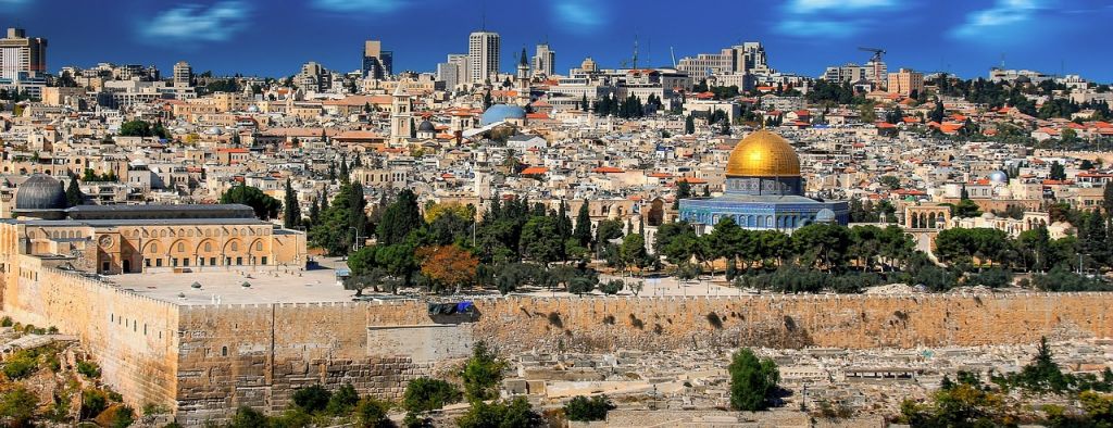
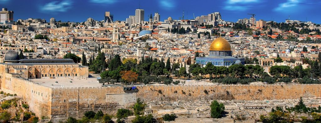
Jerusalem remains a holy city not only for Jewish people, but also for several major religions and communities. Its latitude is about 31.783° north.
Chang’an, the royal capital of ancient China and today’s Xi’an, lies at about 33.42° north. Slightly farther north, at around 34.26° north, is the Himorogi-ishi, a sacred megalithic stone at Iwakami Shrine on Awaji Island.
This curious relationship is sometimes described as a “Path of the Sun.” One theory suggests that ancient Jewish people, who were skilled in astronomy, may have used such an eastward route as a guide while traveling toward the Far East.
Ancient Jewish religion is often discussed in connection with early solar symbolism, and Japan’s highest deity, Amaterasu Omikami, is also known as a sun goddess. In ancient China, meanwhile, there was a long-standing belief in the importance of earth currents and placing sacred centers at meaningful points in the land. This way of thinking is said to date back to the Yin and Zhou periods.
Seen from the perspective of ancient civilizations and sacred geography, some people interpret this as a ley line on a global scale.
The Line Toward Awaji Island’s Himorogi-ishi
It is certain that many people who came to ancient Japan arrived from the Chinese continent and the Korean Peninsula. However, the origins of certain immigrant clans remain unclear. One famous example is the Hata clan, whose roots are debated. Some theories claim that they may have descended from groups of ancient Jewish people who had settled somewhere on the Asian continent.
Awaji Island’s Himorogi-ishi has long been revered as one of Japan’s sacred stones, believed by some traditions to be a place where a deity descended.
Researchers interested in ley lines have often pointed out that important ruins, sacred sites, and megalithic remains can be found along certain alignments. If Jerusalem in the Middle East, Chang’an in China, and Himorogi-ishi on Awaji Island—an important site on the island regarded in myth as Japan’s first land—are connected, some believe the relationship may have meaning.
Of course, this remains a matter of interpretation rather than proven history.
What Does the Slight Difference in Latitude Mean?
The ultra-long-distance ley line introduced here, stretching from Jerusalem to Chang’an and then to Himorogi-ishi, is not perfectly exact. There are small differences in latitude.
Ley lines are usually understood as intentional straight alignments, but one possible explanation may be more scientific. The first possibility is that the land itself has changed over time.
The latitude figures above are based on modern measurements, not ancient ones. We know that Earth’s continents have shifted over long periods through geological activity. Changes in sea level and gradual changes to the land could also affect how we understand ancient locations today.
In Britain, for example, some carbon-dating research has suggested that St Michael’s Mount, a famous site often discussed in connection with ley lines, may once have been part of a forested area. Some researchers have even suggested that certain megalithic structures may have origins reaching back roughly 10,000 years. Over such an immense span of time, it would not be surprising if the land changed little by little.
Another possibility is that the ancient locations and the modern locations may not match perfectly.
For instance, the ancient Israelites identified Jerusalem with the promised land of Canaan and built the united Kingdom of Israel there. After that, the region experienced repeated wars. War often means divided territory, shifting borders, and changing centers of power. In modern history, the State of Israel was established after World War II.
Some ancient ruins remain in their original form, but when it comes to place names, boundaries, and exact positions, a slight difference should not feel impossible.
If we look at ley lines from a New Age perspective, astronomy is often the first explanation people reach for. But the real answer remains unresolved.
For travelers interested in visiting sacred stones, shrines, or historical sites connected to these stories, please respect local rules, stay on public paths, and do not enter restricted or private areas.
Japanese Language
以前、日ユ同祖論でも紹介したことがありますが、古代ユダヤ人の失われた10支族は東方へ向かって移動を続けて中国大陸に入り、そこから朝鮮半島を通って日本に渡来した可能性を示唆する状況証拠が数多くあります。失われた10支族は南北のイスラエル王国分断後にアッシリアに囚われていた人々でしたが、アッシリアが滅亡したあとも、エルサレムには一部しか帰っていなかったと言われており、10支族は事実上歴史から姿を消してしまったことになります。しかし、 実はユダヤ人の聖地であるエルサレムから、遥か東方である古代中国の首都長安や、日本神話で最初に誕生したと言われている淡路島などはほぼ直線的に繋がっています。
。中東から東アジア大陸をまたにかけた巨大なこのレイライン 上では、各地において 重要な場所がほとんど同じ線の上に立っている のです。果たしてこれらは単なる偶然の一致なのでしょうか?。エルサレムから長安へのレイライン。。現在もユダヤ人だけではなく、いくつかの宗教や人々にとっては聖地とされているエルサレムですが、この場所の北緯は 北緯31.783度 です。そして、古代中国では王都であった長安、現在の西安市は 北緯33.42度に位置しており、この少し北にあたる北緯34.26度の位置に淡路島の岩上神社にある巨石信仰の遺跡、「神籬石(ひもろぎいし)」があります。
。この 不思議な位置関係は太陽の道 とも言われており、天文学に長けていた古代ユダヤ人が東方を目指す際に、このルートを目印にして移動したという説があるのです。古代ユダヤ人は基本的に原ユダヤ教から太陽信仰の民族であり、日本の最高神である天照大神(アマテラスオオミカミ)も太陽の神だと言われています。さらに、古代中国には地脈を重要視する考え方が古代から残っており、大地の中心に信仰の中心をおく習慣があったそうです。この考え方は古代中国では殷周の時代に始まったと言われており、非常に古い時代のものですが、 古代文明の位置関係という意味では、世界規模のレイライン だとも考えられます。
淡路島の神籬石に繋がるレイライン。古代日本に渡って来た渡来人は中国大陸や朝鮮半島から来ていたことは確かですが、有名な渡来人「秦氏」などは出自が不明であり、古代ユダヤ人が中国大陸などで定住していた一部だという説もあるのです。加えて、淡路島の神籬石は古くから神が降臨したと信仰の対象とされてきた巨石の1つです。レイラインの上には各地の重要な遺跡や巨石の遺跡などが存在している ことが研究者の間で指摘されていますが、中東のエルサレムから、長安、そして日本最初の地とされてきた淡路島の重要な遺跡である神籬石が繋がっているということには、何らかの意味があるのかもしれません。
北緯の若干の差は何を意味するのか?。ここで紹介した 「エルサレムから長安、神籬石まで」 の超超距離に及ぶレイラインには若干のズレが存在しています。レイラインの基本は意図した直線ですが、個人的にはここは科学的な解釈が出来ると思っています。1つは 時代の変動による地形の変化 です。上記で紹介した位置関係は、今現在の北緯計算によるものであり、古代のものではありません。地殻変動によって地球の大陸が太古から動いていることは知られていますが、これは海面の上昇や少しずつ大地が変化した結果だとも考えられなくはないでしょう。
イギリスのレイラインにあるセント・マイケルズ・マウントなどは当初は森林であった可能性が炭素年代測定によって推測されていますし、巨石遺構などはそもそもの起源が現在から約10000年前である可能性まで指摘されています。これだけの長期間に及ぶ時代の変化があれば、少しずつ大地にも変化があってもおかしくはないでしょう。もう1つ考えられるのは、 現在と古代の位置が少し違う可能性 です。例えば、古代イスラエル民族であるユダヤ人はエルサレムを約束の地カナンであるとして、統一イスラエル王国を築きましたが、その後に何度も戦争が起こっています。
戦争はすなわち領土の分割であり、近代史においてイスラエル国が建国されたのも第二次世界大戦の後です。もちろん、当時の遺跡としてそのままの姿を残しているものもあれば、 地名や位置に関しては若干の差異があっても不思議だとは感じません 。いずれにせよ、レイラインをニューエイジ的な感覚で見れば、天文学によるものが第一に考えられますが、実際の答えはまだまだ未解明なのです